Kensington Market and Little Italy
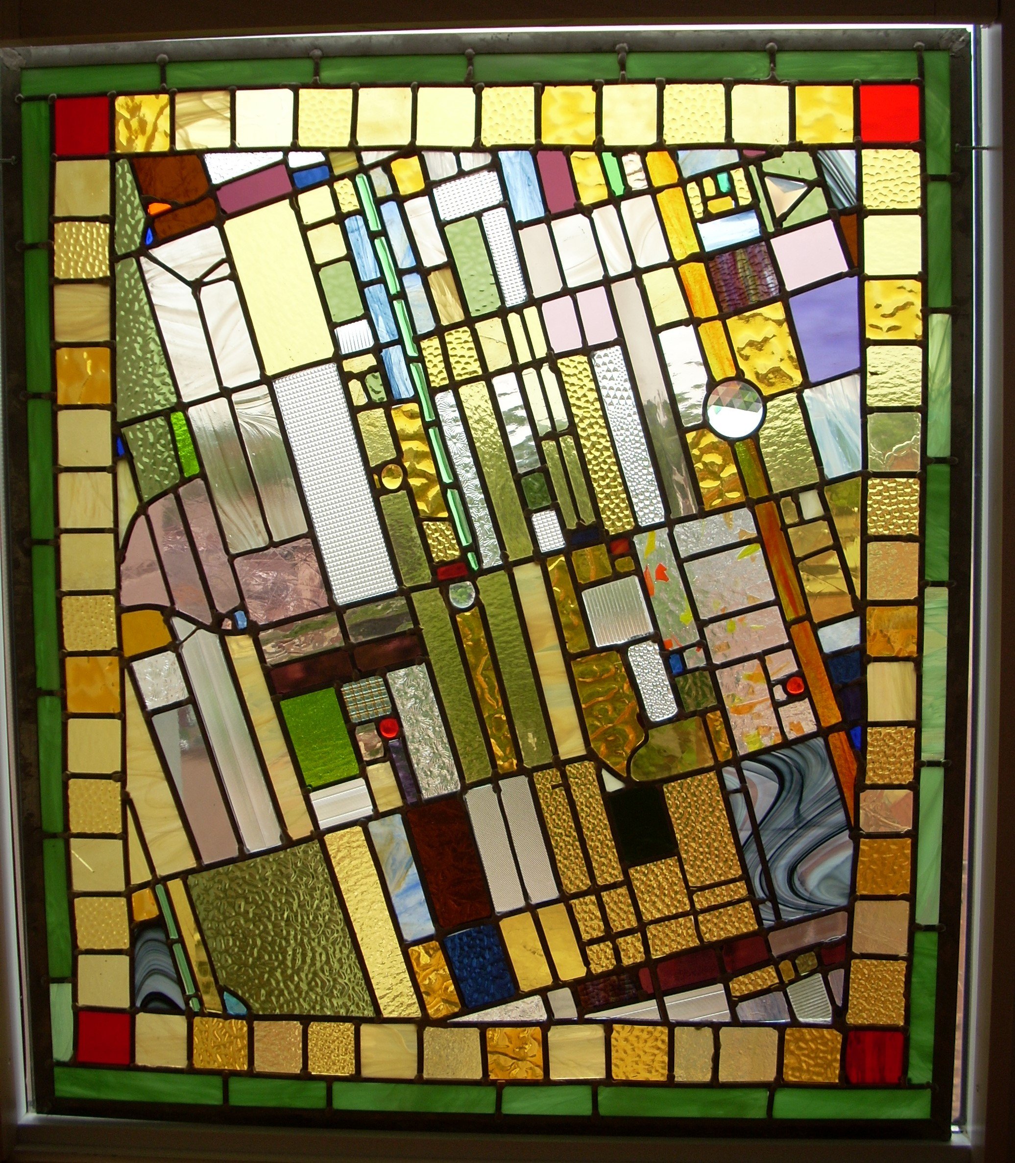
The map is centred at College and Palmerston. At upper left, we see a piece of Christie Pits, and Christie Station. At upper right, Robarts Library. Lower right crosses Queen around Augusta, while lower left has Trinity Bellwoods. The red jewels are the California Sandwich Shop and Pho Hung.
This was my first map. This was in 2009, and I was still reaching for the idea.
The first step was seeing the leads as streets. Then I thought about the effect I wanted. And, the client wanted an absolute screen, with no image visible through either side.
Back then, I was interested in stained glass as mosaic, which made me reach out to Venetian and Byzantine models. That was the source of the border.
In later maps, I suppressed the border and went for a colour-code scheme: essentially a land-use map. My later maps have more clear glass. But this Byzantine approach is still possible, and I would love to make another one.